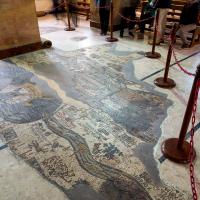
View of map
View of map
Detail: northernmost Area, Jordan River
Detail: Central Area, Jerusalem, Jordan River and Dead Sea
Detail: Southernmost Area, Mount Sinai and Nile Delta at Right
Detail: Southernmost Area, Mount Sinai and Nile Delta at Right
Detail: Southernmost Area
Detail: Central Area. Hebron and Fragments of Mediterranean Sea
Detail: Central and northern Areas, Hebron, Bethlehem and Jerusalem
Detail: Central and northern Areas, Jordan River, Dead Sea, Jericho
Detail: Central Area, Dead Sea
Detail: northern Area, Jordan River, Jericho, Jacob's Well
Detail: River Jordan, Boat
Detail: Jericho
Detail: Jerusalem
Detail: Dead Sea
Detail: Central Area, Hebron
Detail: Southernmost Area, Nile Delta and Mount Sinai
Detail: Southern Central Area of Map
Detail: Central Area, Jerusalem and Bethlehem
Detail: Northernmost Area, Jordan River
Detail: North-Central Area, Jericho
Detail: Easternmost Area, Karak
Detail: South-Central Area, eastern Section
Detail: Jerusalem
Detail: Central Area, Western Section
Detail: Jerusalem
Detail: Jerusalem, Cities West of Jerusalem
Detail: Emmaus Nikopolis