Site Profile
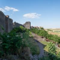
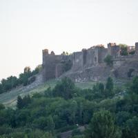
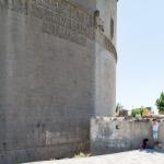
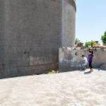
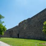
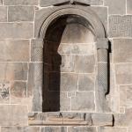
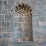
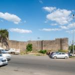
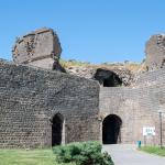
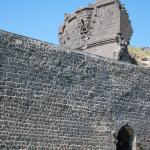
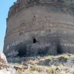
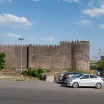
Diyarbakır is a major city in eastern Anatolia sited on the western bank of the upper Tigris River. It has been continually occupied from at least the second millennium BC onwards, and during the period of the Roman Empire—when it was known as Amida—it was a key strategic fortress on the eastern frontier. The foundations of the city’s present fortifications were laid at this time. Measuring over five kilometers in length and interspersed with numerous gates and towers, the walls of Diyarbakır are not only one of the most impressive surviving examples of late antique architecture, but they also comprise the longest stretch of extant pre-modern city wall in the world.
Media
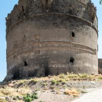
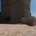
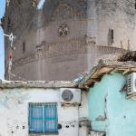
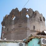
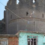
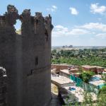
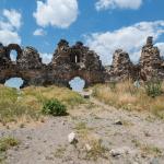
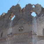
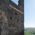
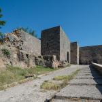
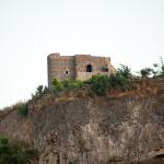
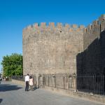
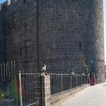
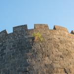
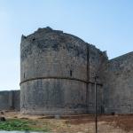
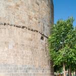
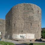
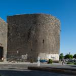
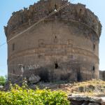
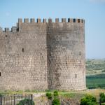
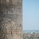
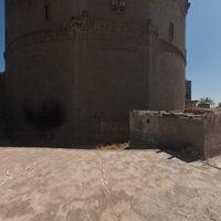
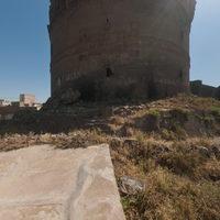
Yedi Kardeş Tower

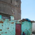

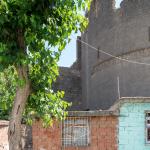

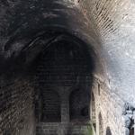
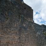
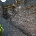


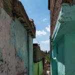
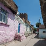


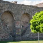


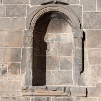
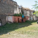
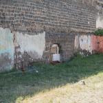
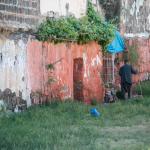
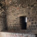
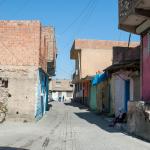
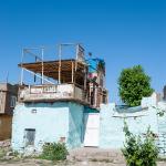
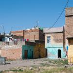
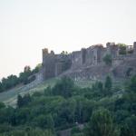
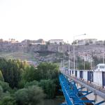
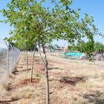
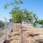
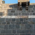
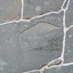
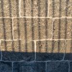
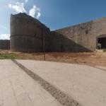
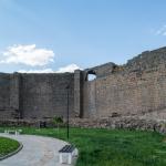
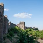
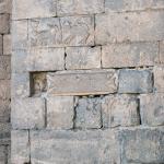
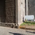
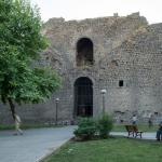
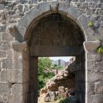
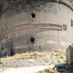
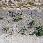
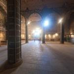
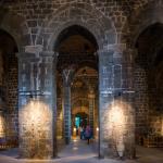
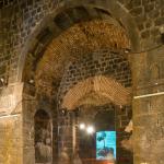
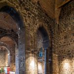
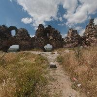
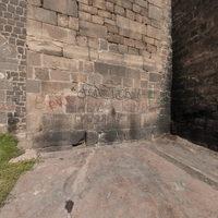
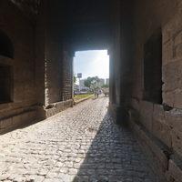
Proximal Walls & Streets


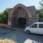
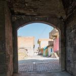


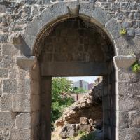
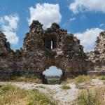
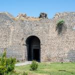
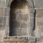
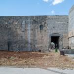
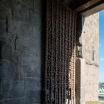
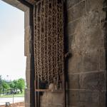
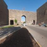
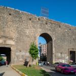
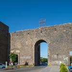
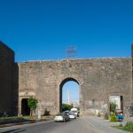
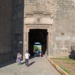
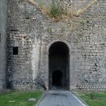
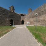
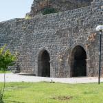
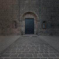
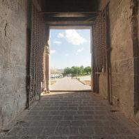
Yeni Kapı (Eastern Gate)
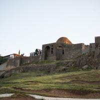
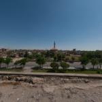
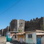
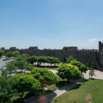
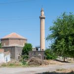
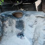
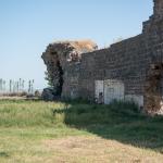
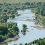
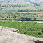
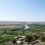
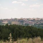
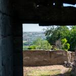
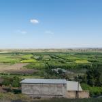
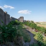
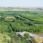
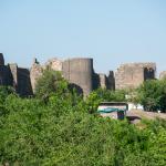
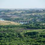
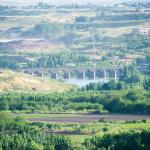
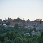
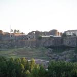
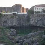
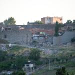
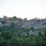
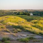
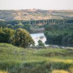
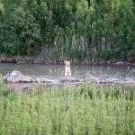
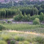
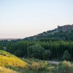
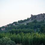
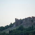
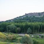
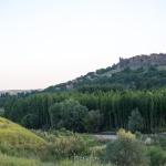
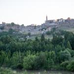
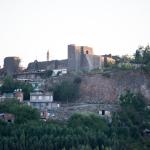
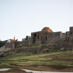
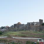
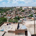
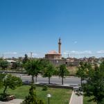
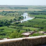
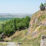
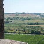
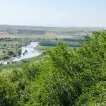
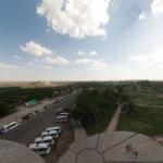
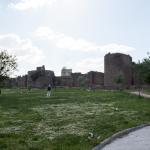
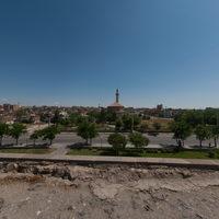
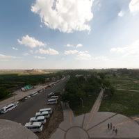
General Views & Surrounding Landscape

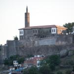


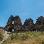
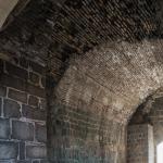
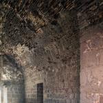
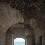
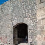
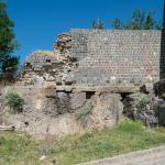
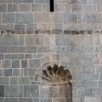
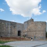
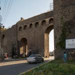
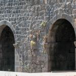
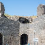
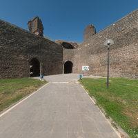
Dağ Kapı (Northern Gate) & Proximal Walls


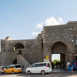
Mardin Kapi (Southern Gate) & Proximal Walls


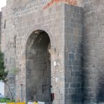
Urfa Kapı (Western Gate) & Proximal Walls


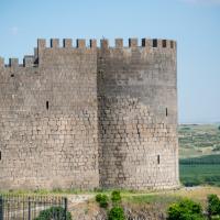
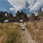
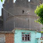
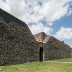
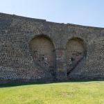
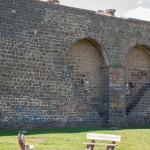
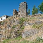
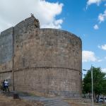
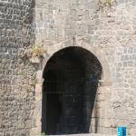
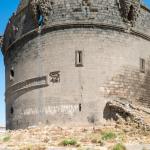
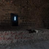
Ulu Beden Tower & Proximal Walls


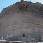
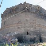

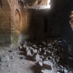
Keçi Tower & Proximal Walls


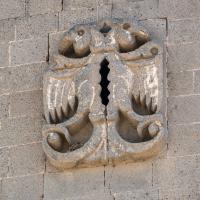
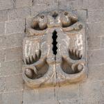
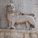
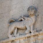
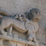
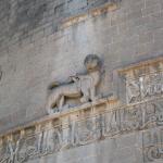
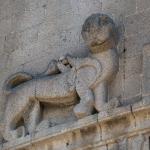
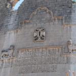
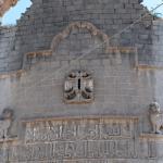
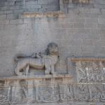
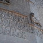
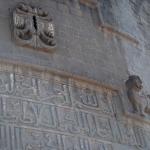
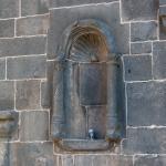
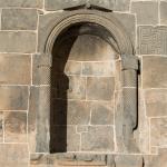
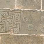
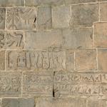
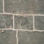
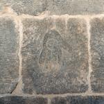
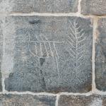
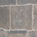
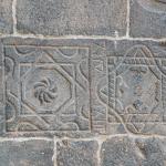
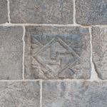
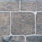
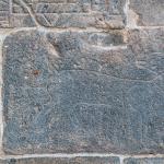
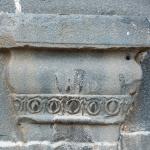
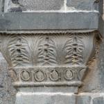
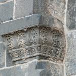
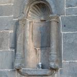
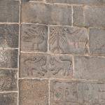
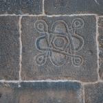
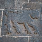
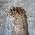
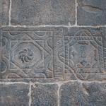
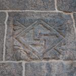
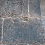
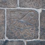
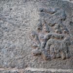
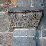
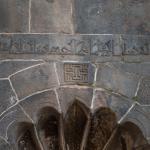
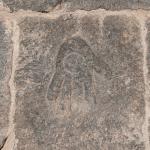
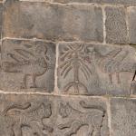
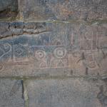
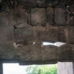
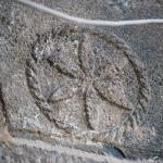
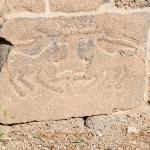
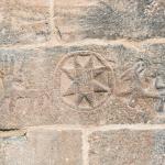
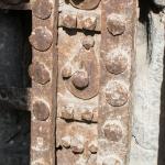
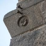
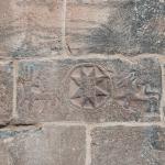
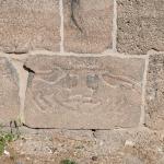
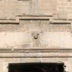
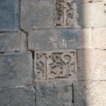
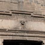
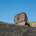
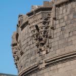
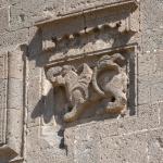
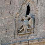
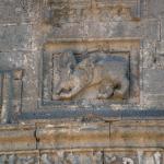
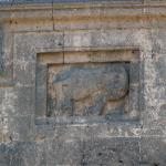
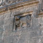
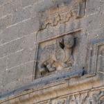
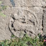
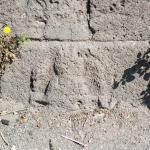
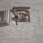
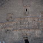
Description & Iconography
'Description & Iconography' general sources: Aslanapa 1962 and 1994; Beysanoğlu 1987, 3–4; Canard and Cahen 1991, 344; Öney 1992; Parla 2005, 58; Thackston 2011, 10; Gierlichs 2016.
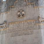
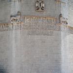
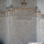
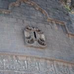
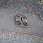
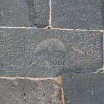
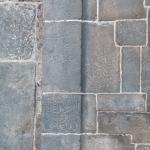
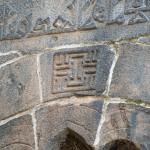
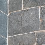
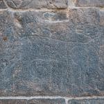
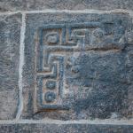
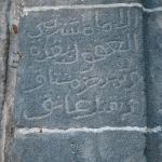
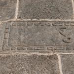
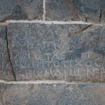
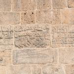
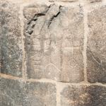
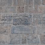
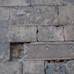
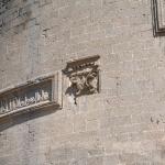
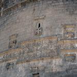
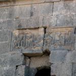
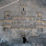
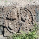
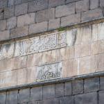
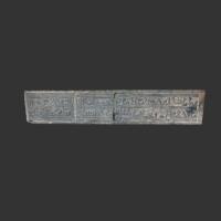
Inscriptions
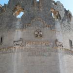
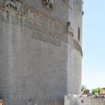
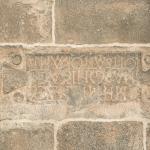
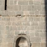
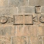
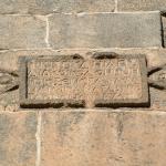
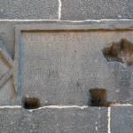
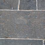
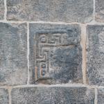
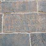
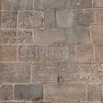
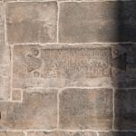
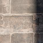
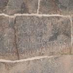
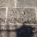
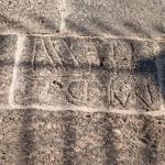
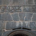
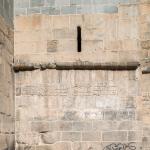
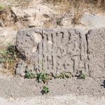
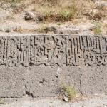
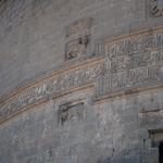
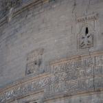
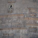
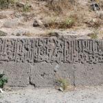
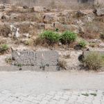
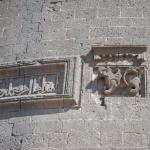
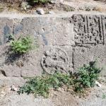
There are 63 extant inscriptions on the walls. Six of them date to the Byzantine period, and the rest belong to the Islamic period, documenting numerous repairs and restorations. The pre-Islamic inscriptions are located on the Dağ Kapı and Mardin Kapı, as well as between the 50th and 53rd bastions; the rest are distributed all around the walls, gates and towers. The inscriptions have been published and translated by a number of scholars.1
- 1. The most extensive discussions of the inscriptions are by van Berchem (1907), van Berchem et. al. (1910), and Sauvaget (1940). Beysanoğlu (1987) provides Turkish translations along with Arabic transcriptions in his detailed historical overview. Analyses of the inscriptions can also be found in Parla (2005), Boran (2011, 84–85), and Tuncer (2012, 103–161).
History
It seems that there was a walled settlement at the site of Diyarbakır from at least the second millennium BC onwards.1 In the early first millennium BC, the city was the capital of a political entity called Bīt Zamāni and was called Amedu (or Amida), a name which remained in use until the late 16th century AD.2 In 866 BC/BCE, the Assyrian king Ashurnasirpal II, campaigning in the Upper Tigris, captured the “royal city” of Amedu, said to belong to a certain Ilanu, “man of Bīt Zamāni.”3 A number of governors of Amedu are mentioned in texts, as eponyms, throughout the 8th century BC. Following the end of the Assyrian state, the rule of the Achaemenids, and the Hellenistic dynasts in the later first millennium BC, Amida fell to the hands of the Romans. At this time, it served as an outpost against the Parthians and the Sasanians; Ammianus Marcellinus, a Roman soldier and historian, lived in the city in 359 AD and provided a description of the pre-Islamic town.4 The Arabs captured the city in 639 AD, after which time a series of dynasties ruled until the Ottomans took over after 1514.
The foundations of the present walls were laid in the 4th century AD and can be dated to the reign of Constantine the Great (r. 307–337) or Constantius II (r. 337–361). Following a substantial enlargement between 367–375, the circuit gained its present form. As documented by the inscriptions, the entire fortification system has undergone numerous successive alterations stretching toward the present day.
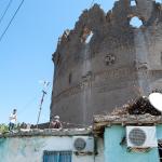
In July 2015, the Diyarbakır city walls, the inner citadel (İç Kale), and the Hevsel Gardens to the southeast of the city were added to the UNESCO World Heritage list.5 In addition, the settlement within the city walls, the Suriçi District—which had already been declared an “Urban Archaeological Site” and “Urban Conservation Area” in 1988—is now regarded by UNESCO as a “buffer zone” to the inscribed world heritage site. Within this area, there are 595 registered cultural heritage sites, including both monumental and civil architecture.
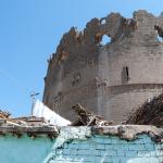
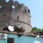
The Mapping Mesopotamian Monuments team documented the site a few months prior to the military clashes of December 2015–March 2016. These clashes were followed by intensive construction work and development projects, which further caused irreversible damage to the surviving structures. Both UNESCO and the World Heritage Watch have expressed concern over significant damage to the urban fabric of the Suriçi District, including the proximal walls and towers.6 As of 2019, UNESCO has recommended a joint World Heritage Centre / ICOMOS Reactive Monitoring mission to assess the overall state of conservation before restorations to the heritage areas proceed.7
- 1. General sources on the city's history: Gabriel 1940, 180–181; Beysanoğlu 1987; Canard and Cahen 1991, 344; Yinanç 1991 [1965], 346; Andersen 2004, 54–59; Parla 2005, 59.
- 2. Some publications suggest that the name of the city can be found on the handle of a sword belonging to the Assyrian king Adad-Nirari I (1295–1264 BC); this idea begins with Gaston Maspero's comment in 'The Struggle of the Nations' (1896, p. 607) that the sword was found 'among the ruins of ancient Amida,' and it was taken further in Beysanoğlu 1987, 3. However, the sword's putative provenance appears to have been mistaken for an inscription. In fact, the city's name is not attested at all in the texts of the second millennium BC (see also Lipinski 2000, 153).
- 3. Grayson 1991, 220 (ll. 105–110).
- 4. Book XVIII, 9, 1–4. See Rolfe 1935, 463–467.
- 5. See the entry in the UNESCO list at: https://whc.unesco.org/en/list/1488.
- 6. See the UNESCO webpage on the condition of the heritage site at: https://whc.unesco.org/en/soc/3970. See also Ayboga 2017.
- 7. https://whc.unesco.org/en/soc/3970.
General sources on the city's history: Gabriel 1940, 180–181; Beysanoğlu 1987; Canard and Cahen 1991, 344; Yinanç 1991 [1965], 346; Andersen 2004, 54–59; Parla 2005, 59.
Early Publications
The Persian writer Nasir-i Khusraw (Nasır-ı Hüsrev) visited the city in 1046 and could not hide his admiration: “I have seen many a city and fortress around the world in the lands of the Arabs, Persians, Hindus, and Turks, but never have I seen the likes of Amid on the face of the earth nor have I heard anyone else say that he had seen its equal.”1 In addition, his account of the outer city wall and its gates provides us with invaluable information, as these features are almost entirely lost today. Evliya Çelebi spent a few weeks in the city in the spring of 1655 and likewise expressed his admiration for its “widely renowned fortification[s]” and its “well-adorned” palace in the inner citadel.2 In the subsequent centuries, numerous European travelers visited the town and recorded their impressions.3
Selected Bibliography
Altun, Ara. 1978. Anadolu’da Artuklu Devri Türk Mimarisi’nin Gelişmesi. Istanbul: T.C. Kültür Bakanlığı.
Andersen, Angela Lyn. 2004. The Diyarbakir Ulu Cami: Social History and Interaction at the Great Mosque. M.A. Thesis, University of Victoria.
Aslanapa, Oktay. 1962. “Erster Bericht über die Ausgrabung des Palastes von Diyarbakır.” Istanbuler Mitteilungen 12: 115–128.
Aslanapa, Oktay. 1994. “Diyarbakır’da Artuklu Sarayı.” III. Milli Selçuklu Kültür ve Medeniyeti Semineri Bildirileri, 7–9. Konya: Selçuk Üniversitesi Basımevi.
Ayboga, Ercan. 2017. "Destruction of the Old City (Suriçi) of Diyarbakır since 2015 and Its Current Status." In World Heritage Watch Report 2017, 109–111.
Beysanoğlu, Şevket. 1986. Anıtları ve Kitâbeleri İle Diyarbakır Tarihi: Birinci Cilt; Başlangıçtan Akkoyunlular'a Kadar. Ankara: Neyir Matbaası.
Boran, Ali. 2011. “Diyarbakır Kalesi.” In Medeniyetler Mirası Diyarbakır Mimarisi, edited by Irfan Yıldız, 77–122. Diyarbakır: T.C. Diyarbakır Valiliği.
Gabriel, Albert. 1940. Voyages archéologiques dans la Turquie orientale. Paris: E. de Boccard.
Gierlichs, Joachim. 2016. “A Victory Monument in the Name of Sultan Malik-Shah in Diyarbakir: Medieval Figural Reliefs Used for Political Propaganda?” Hadeeth ad-Dar 41: 9–15.
Grayson, A. Kirk. 1991. Assyrian Rulers of the Early First Millennium BC. Vol. 1, 1114–859 BC. Toronto: University of Toronto Press.
Korn, Lorenz. 2017. “The Artuqid Residence at Āmid (Diyarbakır).” In Central Periphery? Art, Culture and History of the Medieval Jazira (Northern Mesopotamia, 8th–15th centuries), edited by Lorenz Korn and Martina Müller-Wiener, 153–181. Wiesbaden: Reichert Verlag.
Lipinski, Edward. 2000. The Aramaeans: Their Ancient History, Culture, and Religion. Leuven: Peeters.
Öney, Sezin. 1992. Anadolu Selçuklu Mimari Süslemesi ve El Sanatları. Ankara: Türkiye İş Bankası Kültür Yayınları.
Parla, Canan. 2005. “Diyarbakır Surları ve Kent Tarihi.” ODTÜ Mimarlık Fakültesi Dergisi 22 (1): 57–84.
Rolfe, John C., trans. 1935. Ammianus Marcellinus. Cambridge, MA: Harvard University Press.
Sauvager, Jean. 1940. “Inscriptions Arabes.” In Voyages archéologiques dans la Turquie orientale, by Albert Gabriel, 287–356. Paris: E. de Boccard.
Thackston, Wheeler M. 2001. Nasir-i Khusraw’s Book of Travels. Costa Mesa, CA: Mazda.
Top, Mehmet. 2011. “Diyarbakır Ulu Camii ve Müştemilatı.” In Medeniyetler Mirası Diyarbakır Mimarisi, edited by İrfan Yıldız, 185–226. Diyarbakır: T.C. Diyarbakır Valiliği.
Tuncer, Orhan Cezmi. 2012. Diyarbakır Surları. Ankara: T.C. Diyarbakır Valiliği.
Van Berchem, Max. 1907. "Arabische Inschriften aus Armenien und Diyarbekr." In Materialien zur älteren geschichte Armeniens und Mesopotamiens, by C. F. Lehmann-Haupt, 125–160 (1–36). Berlin: Weidmannsche Buchhandlung.
Van Berchem, Max, Josef Strzygowski, and Gertrude Bell. 1910. Amida. Heidelberg: Carl Winter’s Universitätsbuchhandlung.
Van Bruinessen, Martin, and Hendrik Boeschoten. 1988. Evliya Çelebi in Diyarbekr. Leiden: Brill.
Yinanç, Mükrimin Halil. 1991 [1965]. “Diyâr Bakr: Ottoman Period.” The Encyclopaedia of Islam. Vol. 2. Leiden: Brill.