Site Profile
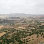
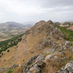
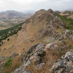
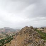
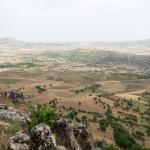
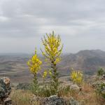
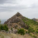
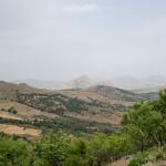
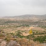
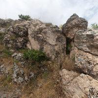
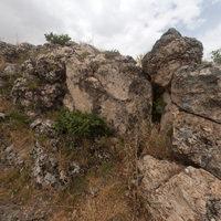
The Gisgis rock relief is located 15 km southwest of Ergani, in the province of Diyarbakır. Situated on the summit of a relatively inaccessible natural rock formation (elevation: 3743 feet/1149 m), the relief faces southwest, overlooking the village of Kesentaş and the plain surrounding it. Among the series of Neo-Assyrian rock reliefs in the Upper Tigris region, the Gisgis relief represents the westernmost example (see also Eğil and Bırkleyn reliefs). The Mapping Mesopotamian Monuments team documented the site in 2015. Everyone whom the team met with in the village had long known the relief and felt responsible for its protection.
Media

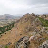

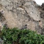
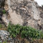
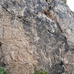
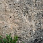
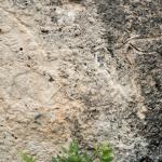
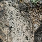
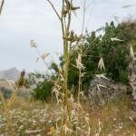
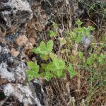
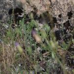
Surrounding Landscape & Local Foliage

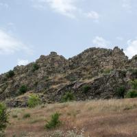
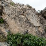
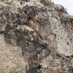
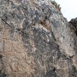
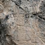
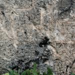
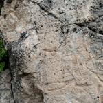
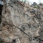
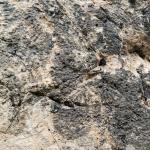
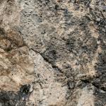
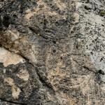
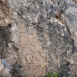
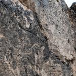
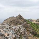
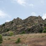
Rock Relief (Full View)

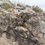
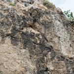
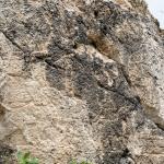
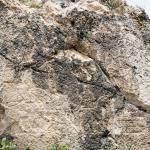
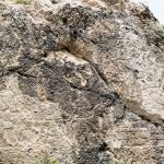

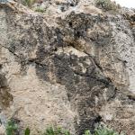
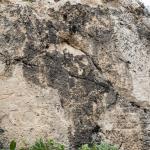
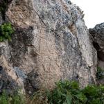
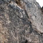

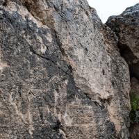
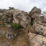
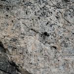
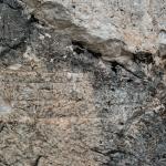
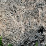
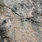
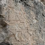
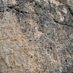
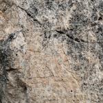
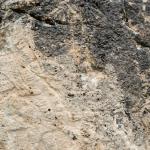
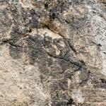
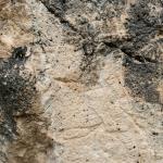
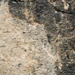
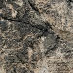
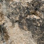
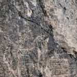
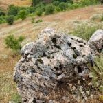
Rock Relief (Detail Views)


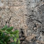

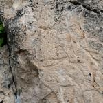

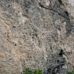


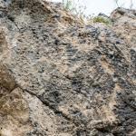


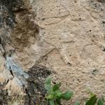


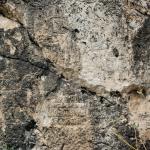


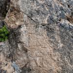


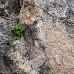

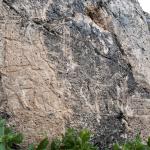
Surrounding Landscape & Local Foliage


Description & Iconography
'Description & Iconography' general sources: Thureau-Dangin and Dunand 1936; Köroğlu and Yumruk 2014; Köroğlu 2016.
Inscriptions
There is no visible inscription accompanying the relief.
History
The dating of the relief to the mid- to late 8th century BC, suggested on the basis of stylistic and iconographical features, seems to fit well with the historical context.1 The region of the Upper Tigris where the Gisgis rock relief is located was one of the disputed areas between Assyria and Urartu in this period; rather than signifying the exact border between these two major states, however, the relief rather seems to indicate the westernmost territory of the Upper Tigris reached by the Assyrian armies. Additionally, with its remarkable location on the summit of a formidable rock formation, the relief follows the general tendency for Neo-Assyrian rock reliefs to be sited in symbolically charged, but not necessarily easily accessible and visible places.
- 1. Köroğlu and Yumruk 2014.
Early Publications
On July 24th, 1899, the American geographer Ellsworth Huntington wrote to the German historian Carl Friedrich Lehmann (who took the last name “Lehmann-Haupt” in 1905) that a “priest from Arghaneh [Ergani]” had informed him about a rock relief in a village called Hilar, situated “two hours south of Arghaneh [Ergani],” showing “a king and a priest,” with “inscriptions all around it.'1 Although E. Unger claims that Huntington saw the relief himself, Huntington actually states that he could not get an official permit to visit the site and had to cancel the trip; nevertheless, Unger’s account has been repeated by scholars discussing the relief.2
In fact, Huntington was able to make a visit to Hilar only two years later, in 1901. His detailed account of his trip begins with the same mention of a local tip regarding the existence of a relief “represent[ing] a king facing a priest, while all around them were letters of a kind which no one could read.”3 Yet it is clear from his descriptions and the accompanying plan that he actually went to the site known as the “Hilar caves,” 13 km east of Gisgis/Kesentaş, located just south of the village of Hilar (modern Sesverenpınar), close to the mound of Çayönü. The remains he describes belong to a series of rock-cut tombs of the Roman era. In fact, his 'Tomb no. 8' bears a relief panel depicting two figures accompanied by a “Syriac inscription.” Therefore, there seems to be two possibilities: a) the local priest who tipped off Huntington was actually referring to 'Tomb 8' at the Hilar caves, and not to the Gisgis relief; or b) the priest did indeed refer to the Gisgis relief, but Huntington mistakenly associated Tomb 8 with it and did not feel the need to investigate further. As there is no inscription accompanying the Gisgis relief, the first possibility seems to be more likely. Nonetheless, it is clear that Huntington never went to the actual site of the Gisgis relief.
- 1. See Lehmann 1900, 141; translation by Helen Malko.
- 2. Unger 1925, 204; Huntington 1903, 141–142. Scholars referring to Unger's account include Börker-Klähn 1982, 193; Köroğlu and Yumruk 2014, 2.
- 3. On the portion of Huntington's trip involving Gisgis, see Huntington 1903, 136–139, figs. 4 and 15.
Selected Bibliography
Börker-Klähn, Jutta. 1982. Altvorderasiatische Bildstelen und vergleichbare Felsreliefs. Mainz am Rhein: P. von Zabern.
Huntington, Ellsworth. 1903. “The Hittite Ruins of Hilar, Asia Minor.” Records of the Past 2: 131–140.
Köroğlu, Kemalettin. 2016. “Anadolu’daki Yeni Assur Dönemi Stelleri ve Kaya Kabartmaları: İlk Sonuçlar.” Türk Eskiçağ Bilimler Enstitüsü Haberler 41: 8–12.
Köroğlu, Kemalettin, and Şeref Yumruk. 2014. “Ergani/Gisgis (Kesentaş) Yeni Assur Kabartması.” Türk Eskiçağ Bilimler Enstitüsü Haberler 38: 2–8.
Lehmann, C. F. 1900. “Hr. C.F. Lehmann macht Mittheilungen aus englischen Briefen des Hrn. Ellsworth Huntington über armenische Alterthümer.” Zeitschrift für Ethnologie 32: 140–152.
Thureau-Dangin, F., and Maurice Dunand. 1936. Til Barsib. Paris: P. Geuthner.
Unger, E. 1925. “Felsdenkmal.” Reallexikon der Vorgeschichte 3: 205–207.