Site Profile
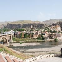
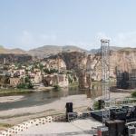
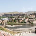
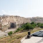
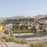
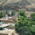
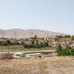
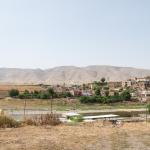
Hasankeyf is located along the upper Tigris River in Anatolia, in the Batman Province of modern Turkey; it lies about 30 km southeast of the city of Batman and just over 100 km east of Diyarbakır. Although the town was already settled in antiquity, its greatest floruit was during the 12th to 15th centuries under the Artuqid dynasts, when remarkable examples of medieval architecture were built here. The upper city once occupied a breathtaking location atop a ravine of the river. However, since the completion of the Ilısu Dam in the summer of 2019—subsequent to the MMM team's documentation—most of this fascinating site has been submerged underwater.
Media

and Imam Abdullah Mausoleum)
Artuqid Bath
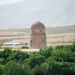
Lower Town (Zeynel Bey Tomb
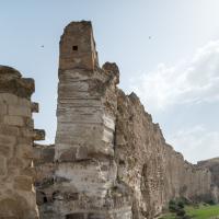
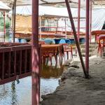
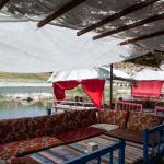
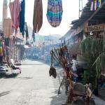
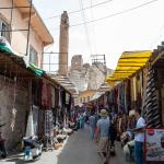
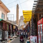
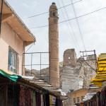
General Views of Hasankeyf (Interior)
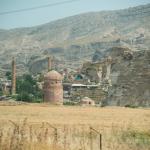
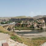
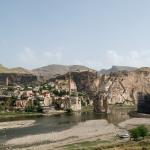
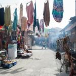
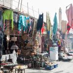
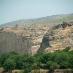
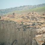
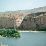
General Views of Hasankeyf (Exterior)
General Views of Hasankeyf (Interior)


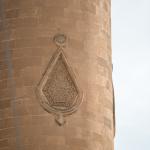
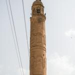
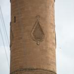
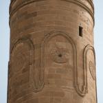
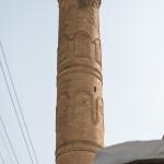
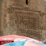
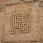
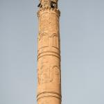
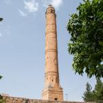
El-Rizk Mosque
Great Palace
Küçük Saray (Small Palace)
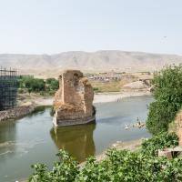
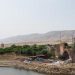
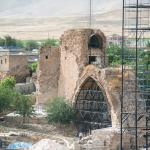
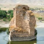
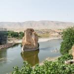
Stone Bridge Ruins
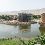
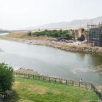
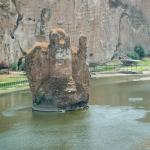
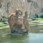
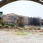
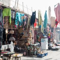
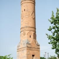
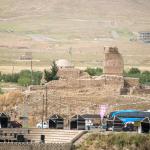
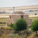
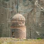
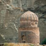
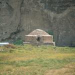
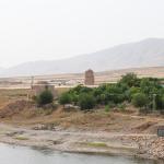
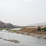
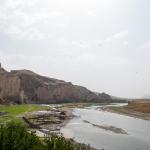
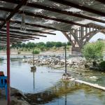
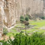
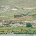
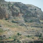
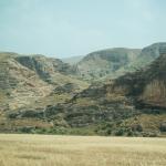
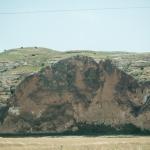
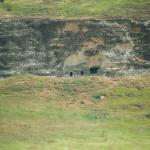
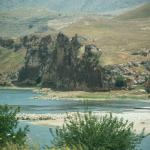
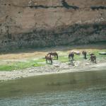
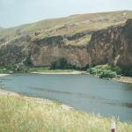
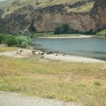
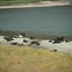
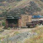
Surrounding Landscape & Structures
Description & Iconography
'Description & Iconography' general sources: Gabriel 1940, 63–78; Eyice 1994, 283; Meinecke 1996, 61–76; Oğuzoğlu 1997, 365; Schneider 2008; Fındık et al. 2014.
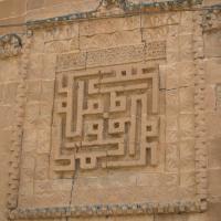
Inscriptions
History
Excavations at Hasankeyf Höyük, located 2 km east of the medieval town of Hasankeyf, indicate that the history of the site's occupation goes back to the Neolithic era (10th millennium BC, Pre-Pottery Neolithic B); the earliest settlement was contemporary with the sites of Hallan Çemi, Körtik Tepe, Demirköy Höyük, and Gusir Höyük. The earliest potential textual attestation is found in the Mari texts (2nd millennium BC), where the site is possibly referred to as the capital of the kingdom of Ilānṣurā, a toponym also known from the Hittite texts. In the first millennium BC, the area of Hasankeyf was probably under the control of Bīt Zamāni or belonged to the land of Nirbu. What is certain is that in the 9th century BC, the region of Hasankeyf was incorporated into the Assyrian province of Tušḫan, the capital city of which is now equated with the 50 km upstream site of Ziyaret Tepe.
After the rule of the Achaemenid Persians and Hellenistic monarchs, the area of Hasankeyf served as a strategically important frontier point between the Romans and the Parthians and later, the Sasanians. Located just north of the cloisters of Ṭūr ‘Abdīn (which was known as “Kašiari mountains” in the Assyrian sources), Hasankeyf is mentioned as the seat of a Nestorian bishopric during the Council of Chalcedon (451 AD). In the late Roman sources, the city is referred to as Kiphas, Cepha/Ciphas, or Castron Riskephas, all of which derive fromm the Syriac kifo (“rock').
After the capture of the town by the Muslim Arabs in 640, there is scant information concerning the site until the short-lived rule of the Hamdanids and Marwanids; following on this, the Seljuqs handed it as a fief to the Artuqids (1102–1231). Hasankeyf flourished, controlling the major caravan routes to Diyarbakır and Mosul by way of its magnificent bridge. The 130-year-long period of Artuqid rule—characterized by a series of political maneuverings between the kingdom's more powerful neighbors, the Anatolian Seljuqs and the Ayyubids—came to an end with the Ayyubid conquest of Hasankeyf in 1232. Subsequent to the sack of the town in 1260 by the Mongols, the Ayyubid branch in Hasankeyf managed to survive, at times under the authority of the Kara Qoyunlu and then the Aq Qoyunlu. During the rule of the sons of the Aq Qoyunlu Uzun Hasan, the town witnessed another brief period of rebuilding, which terminated with the conquests of the Safavid Shah Ismail and then the Ottomans (1516). Hasankeyf flourished as a middle-scale commercial center during the earlier part of the Ottoman era—serving, for instance, as a major supplier of cotton to the city of Venice.1 However, it gradually dwindled to a small town from the 17th century onwards. Today, it is a small district (ilçe) of the Batman Province.
Hasankeyf was declared a “First Degree Archaeological Site” by the Turkish government in 1981 and archaeological excavations have been conducted at the site from 1986 onwards.2 In 1997, the Turkish government announced plans for a large-scale hydroelectric power plant (Ilısu Dam) on the Tigris within the context of the Southeastern Anatolia Project (GAP), which would flood a significant portion of Hasankeyf, as well as numerous other unexplored archaeological sites on both banks of the Tigris.3 Despite various local and international campaigns and a series of lawsuits against the project,4 the construction of the Ilısu Dam was ongoing when the Mapping Mesopotamian Monuments team documented Hasankeyf in 2015. Shortly thereafter, in preparation for the flooding of the site, the Turkish government relocated eight of the buildings in the lower town to a “cultural park” near the recently constructed residential unit called “New Hasankeyf,” a couple of kilometers away from the site, where many of the town's residents have resettled.5
- 1. Rizk Khoury 1997, 33–34.
- 2. See information on the history of excavations at http://www.xn--hasankeyfkazlar-jlcd.org.tr/hasankeyf/#arastirma.
- 3. See an overview of the project and its controversial history on the website of the Initiative to Keep Hasnkeyf Alive: http://www.hasankeyfgirisimi.net/?page_id=6.
- 4. E.g. the Initiative to Keep Hasankeyf Alive (http://www.hasankeyfgirisimi.net/?page_id=2); Susanne Güsten. 'Court Case Could Slow Turkish Dam Project.' New York Times, March 30, 2011.
- 5. Ali Kucukgocmen. 'History Disappears' as Dam Waters Flood Ancient Turkish Town.' Reuters, February 25, 2020. https://www.reuters.com/article/us-turkey-dam/history-disappears-as-dam-.... The methods used for the relocation of the monuments have been criticized by a number of heritage organizations; see, e.g., the statement from Europa Nostra: https://www.europanostra.org/europa-nostras-board-gives-statement-endang....
'History' general sources: Darkot 1950, 452; Ory 1971, 507; Astour 1992; Oğuzoğlu 1997, 364–366; Miyake et al. 2012; Fink 2017, 2–6.
Early Publications
Numerous travelers throughout the long history of Hasankeyf visited the city and recorded their impressions. One of the earliest sources concerning Medieval Hasankeyf is the 10th-century geographer al-Makdisī, who gives an account of a lively town with multiple churches, bazaars, and inns.1 Ibn al-Azraq (d. 1176–77) mentions the existence of the Hasankeyf bridge.2 Al-Jazarī, the author of the famous treatise on automata,3 states that he entered the services of the Artuqid rulers of Hasankeyf in 1174–75 and later moved to Diyarbakır/Âmid when the Artuqid court was transferred.4 He writes in his treatise that he created for the Artuqid palace at Hasankeyf a bronze door highly embellished with metal inlays and spectacularly designed door knockers:
- “[…] I made for each leaf a ring [a knocker] from cast brass in the shape of two connected serpents, the head of one facing the head of the other. Their mouths are open as if they wished to devour the neck and head of a lion [that is placed between the serpents].”5
Petaḥyah ben Ya֫aḳov, a rabbi from Regensburg, visited Hasankeyf on his way to Jerusalem in the late 12th century; he was perhaps the first scholar to work on the etymology of the town's name.6 Yaqut al-Hamawi (Yâkūt el-Hamevî, d. 1229) expressed his admiration for the Tigris bridge,7 while Ibn Shaddād (d. 1285) gave an eyewitness account of the Ayyubid town, counting a royal residence (Dār al-Salṭana), mosques, madrasas, hammams, bazaars and caravanserais.8 Interestingly, it is stated in a later colophon added to Ibn Shaddād’s book that one of the Ayyubid rulers of Hasankeyf, al-ʿĀdil Sulaimān, had showed interest in the book and personally transcribed it.9
Hamdallah Mustawfi (Hamdullāh el-Müstevfî, d. 1349) points to the fact that the fortunes of the city began to decline in the 14th century.10 Two famous Venetian travelers, Giosafat Barbaro (1413–1494) and Giovanni Maria Angiolello (1451–ca. 1525) visited the area in the 15th century and referred to the town as “Asancheph” and “Arsunchief” respectively.11 Evliya Çelebi passed through the site in 1656 and noted that he failed to find words to express the beauty of the Tigris bridge.12
Among those who visited the site in the 19th century are Helmuth von Moltke, later chief of staff of the Prussian army; the British Consul-General for Diyarbakır, J. G. Taylor; and the Assyriologist Carl Friedrich Lehmann-Haupt.13 All of them mention that the bridge was already in ruins at that time.
In the early 20th century, Gertrude Bell visited and photographed the site;14 Albert Gabriel published a detailed documentation of the monuments in 1940.15
- 1. Oğuzoğlu 1997, 365.
- 2. See Schneider 2008, 6–7.
- 3. See Hill 1974.
- 4. See Meinecke 1996, 62–63.
- 5. Translation: Hill 1974, 94.
- 6. Fink 2017, 2.
- 7. Darkot 1950, 453.
- 8. Meinecke 1996, 65.
- 9. Meinecke 1996, 71.
- 10. Oğuzoğlu 1997, 366.
- 11. Fink 2017, 6.
- 12. See Ertaş 2011, 46.
- 13. Von Moltke 1841, 236–237; Taylor 1865, 32–33; Lehmann-Haupt 1910, 373–380.
- 14. http://gertrudebell.ncl.ac.uk/photos.php
- 15. Gabriel 1940. For a list of other, less-known travelers, see Miynat 2009.
Selected Bibliography
Ahunbay, Zeynep. 2008. “Hasankeyf, a Site Threatened by the Ilısu Dam Project.” In Heritage at Risk: ICOMOS World Report 2006–2007 on Monuments and Sites in Danger, edited by Michael Petzet and John Ziesemer, 156–57. Altenburg: E. Reinhold.
Astour, Michael C. 1992. “The North Mesopotamian Kingdom of Ilānṣurā.” In Mari in Retrospect: Fifty Years of Mari and Mari Studies, edited by Gordon D. Young, 1–33. Winona Lake, IN: Eisenbrauns.
Darkot, Besim. 1967. “Hisn Keyfâ.” In Islâm Ansiklopedisi: Islâm âlemi coğrafya, etnografya ve biyografya lûgati, vol. 5, pt. 1: 452–454. Istanbul: Millî Eğitim Basimevi.
Ertaş, Mehmet Yaşar. “Evliya Çelebi Seyahatnamesi’nde Yollar: Kaldırımlar, Köprüler ve Kervansaraylar.” Pamukkale University Social Sciences Institute Journal 10: 43–53.
Eyice, Semavi. 1994. “Dicle Köprüsü.” In Türkiye Diyanet Vakfı Islam Ansiklopedisi, vol. 9: 283–284. Istanbul: Türkiye Diyanet Vakfı.
Fındık, Nurşen Özkul, Ali Akın Akyol, and Nurşen Sarı. “Archaeometric Analyses of Hasankeyf Unglazed Ceramics.” Mediterranean Archaeology and Archaeometry 14 (1): 261–271.
Fink, Andreas. 2017. Der arabische Dialekt von Hasankeyf am Tigris (Osttürkei). Wiesbaden: O. Harrassowitz.
Gabriel, Albert. 1940. Voyages archéologiques dans la Turquie orientale. Paris: E. de Boccard.
Hill, Donald R. 1972. The Book of Knowledge of Ingenious Mechanical Devices by Ibn al-Razzāz al-Jazarī. Boston: Dordrecht.
Lehmann-Haupt, Carl F. 1910. Armenien, Einst und Jetzt: Reisen und Forschungen von C.F. Lehmann-Haupt. Vol. 1, Vom Kaukasus zum Tigris und nach Tigranokerta. Berlin: B. Behr’s Verlag.
Meinecke, Michael. 1996. Patterns of Stylistic Changes in Islamic Traditions: Local Traditions versus Migrating Artists. New York: New York University Press.
Miyake, Yutaka, Osamu Maeda, Kenichi Tanno, Hitomi Hongo, and Can Y. Gündem. 2012. “New Excavations at Hasankeyf Höyük: A 10th Millennium cal. BC Site on the Upper Tigris, Southeast Anatolia." Neo-Lithics 1/12: 3–7.
Miynat, Ali. 2009. “Batılı Seyyahların Gözüyle Hasankeyf.” In I. Uluslararası Batman ve Çevresi Tarihi Sempozyumu, edited by Salim Cöhce and Adnan Çevik, 182–198. Batman: Batman Valiliği.
Oğuzoğlu, Yusuf. 1997. “Hasankeyf.” Türkiye Diyanet Vakfı İslâm Ansiklopedisi, vol. 16: 364–368. Istanbul: Türkiye Diyanet Vakfı.
Ory, Solange. 1971. “Ḥiṣn Kayfā.” In Encyclopedia of Islam, Vol. 3: 506–509.
Rizk Khoury, Dina. 1997. State and Provincial Society in the Ottoman Empire: Mosul, 1540–1834. Cambridge: Cambridge University Press.
Sauvaget, Jean. 1940. “Inscriptions Arabes.” In Voyages archéologiques dans la Turquie orientale, by Albert Gabriel, 287–356. Paris: E. de Boccard.
Schneider, Peter I. 2008. Die Rizk-Moschee in Hasankeyf: Bauforschung und Baugeschichte. Byzas 8. Istanbul: Ege Yayınları.
Sinclair, Thomas A. 1989. Eastern Turkey: An Architectural and Archaeological Survey. Vol. 3. London: Pindar.
Taylor, J. G. 1865. “Travels in Kurdistan, with Notices of the Sources of the Eastern and Western Tigris, and Ancient Ruins in Their Neighbourhood.” The Journal of the Royal Geographical Society of London 35: 21–58.
Von Moltke, Helmuth. 1841. Briefe über Bestände und Begebenheiten in der Türkei aus den Jahren 1835 bis 1839. Berlin: Mittler.
Whelan, Estelle. 1988. “Representations of the Khāṣṣakīyah and the Origins of Mamluk Emblems.” In Content and Context of Visual Arts in the Islamic World, edited by Priscilla P. Soucek, 219–243. University Park, PA.: Published for the College Art Association of America by the Pennsylvania State University Press.