Site Profile
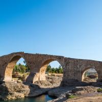
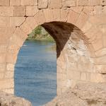
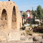
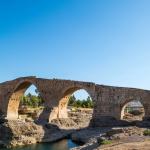
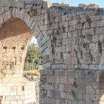
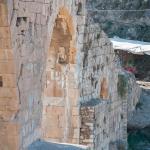
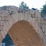
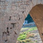
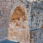
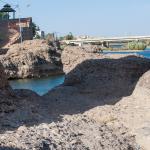
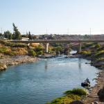
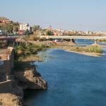
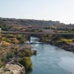
The Zakho Bridge, sometimes referred to as the Abbasid Bridge or the Delal Bridge, is located in the city of Zakho in the northwest of Iraqi Kurdistan, about 50 km north of Duhok and close to the border of Turkey. Zakho is situated between two mountain chains known as al-Judi. The bridge is located in the southeast of the city and spans the Khabur River, which flows from the direction of Turkey, eventually feeding into the Tigris River. It was most likely first constructed in antiquity, along with a medieval rebuilding.
Media

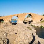
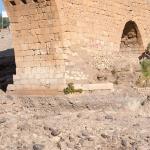
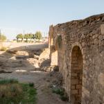
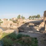
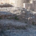
Surrounding Area

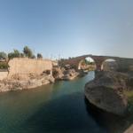
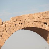
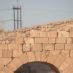
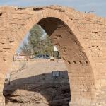
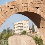
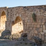
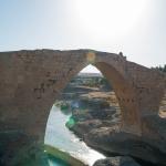
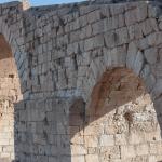
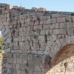
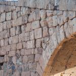
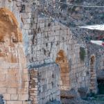
Bridge: Views from the East
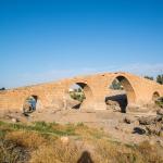
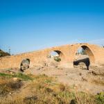
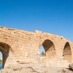
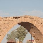
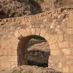
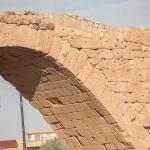
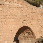
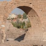
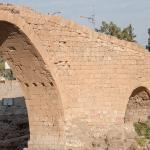
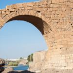
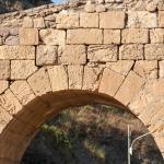

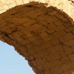
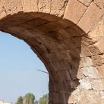
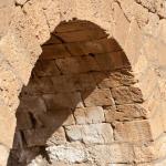
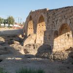
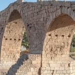
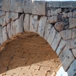
Bridge: Views from the West
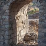
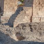

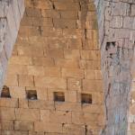
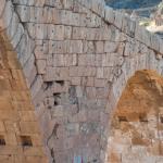
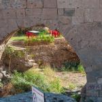
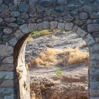
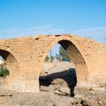
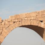
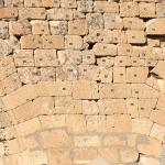
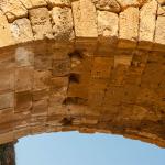
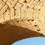
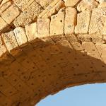
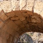
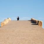
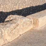
Bridge: Upper Surface
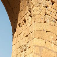
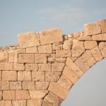
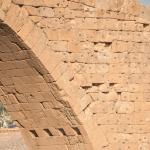
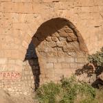
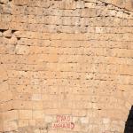
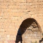
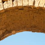
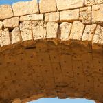
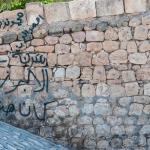
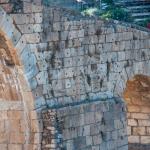
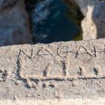
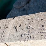
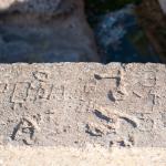
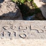
Bridge: Graffiti Details
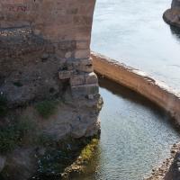
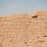
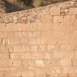
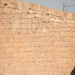
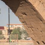
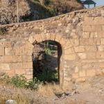
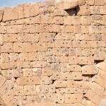
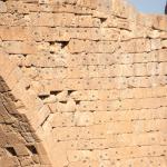
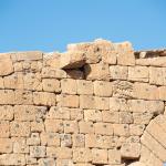
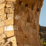
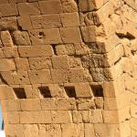
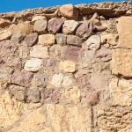
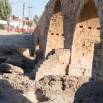
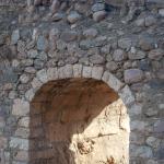
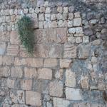
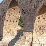
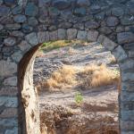
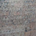
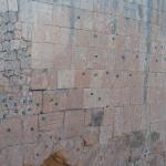
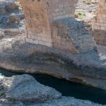
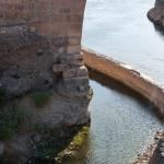
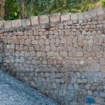
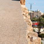
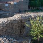
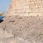
Adjacent Masonry
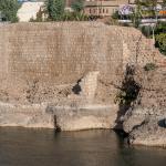
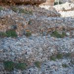
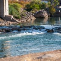
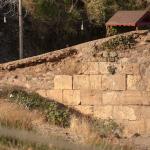
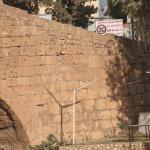
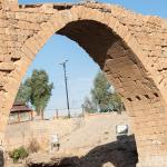
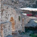
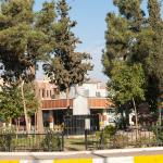
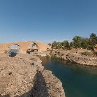
Surrounding Area

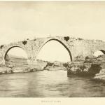
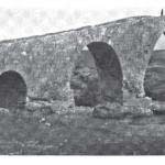
Historical Photographs
Supplementary Images

Description & Iconography
“Description & Iconography” general sources: Preusser 1911, 22–23; Çulpan 1975, 83; Pavelka 2010.
History
Due to the lack of inscriptions, iconography, the origin of the Zakho Bridge remains unclear. Several theories have been put forward suggesting various dates for the bridge, from as early as the Assyrian period to as late as the Abbasid period. It is generally accepted that the original bridge dates to antiquity, with a subsequent rebuilding in the medieval period, perhaps in the 12th–13th century. Whatever its original construction date, the bridge has long remained the focal point of the city of Zakho, and the local communities consider it an important part of their heritage and pride in their ancient city.
The origin of the variant name of the bridge, Delal, is unknown. But Mark Sykes attributed it to a local legend.1 He claims that according to a story set during the medieval period, the builders could not make the main arch come together no matter how many times they tried to join the two ends together. Finally, Delal, the daughter-in-law of the local ruler, was sacrificed and buried under the bridge, resulting in the completion of the arch.
- 1. Sykes 1904, 160; see also Khan 2008.
“History” general sources: ʻAbbāsī 1948; Gazzola 1963, 171 (no. 252).
Early Publications
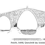
In his 1904 travelogue, the British military officer and diplomat Mark Sykes briefly described and published an early photograph of the Zakho bridge.1 In 1911, the German scholar Konrad Preusser more carefully analyzed the bridge, not only photographing it but also creating a useful diagram of its elevation.2 Gertrude Bell photographed the bridge—along with her copious images of the city of Zakho—in 1922.3 In 1948, Khiḍr ʻAbbāsī published a detailed study of the bridge and its history.4
- 1. Sykes 1904, 160.
- 2. Preusser 1911, 22–23.
- 3. Gertrude Bell Archive, Album H (http://gertrudebell.ncl.ac.uk/personalia.php?photo_id=203).
- 4. ʻAbbāsī 1948.
Selected Bibliography
ʻAbbāsī, Khiḍr. 1948. Tārīkh baldat Zākhū wa-al-jisr al-ʻAbbāsī: ṣafḥah majhūlah fī tārīkh al-ʻIrāq fī al-fatrah al-muẓlimah [The history of the town of Zakho and the Abbasid Bridge: An unknown page in the history of Iraq in the Dark Age]. Baghdad: Dār Dijlah lil-Ṭibāʻah wa-al-Nashr (in Arabic).
Çulpan, Cevdet. 1975. Türk taş köprüleri: Ortaçağdan Osmanlı devri sonuna kadar [Turkish stone bridges: From the medieval to the end of the Ottoman period]. Ankara: Türk Tarih Kurumu (in Turkish).
Gazzola, Piero. 1963. Ponti romani. Vol. 2, Contributo ad un indice sistematico con studio critic bibliografico. Florence: Olschki.
Khan, Geoffrey. 2008. “The Bridge of Zakho.” In The Neo-Aramaic Dialect of Barwar, 2156–2157. Leiden: Brill.
Pavelka, Karel. 2009. “Detailed Documentation and 3D Model Creation of Dalal Bridge Using Terrestrial Photogrammetry in Zakhu, Northern Iraqi Kurdistan.” CXXII CIPA Symposium, Kyoto, Japan, 11 October–15 October 2009: Proceedings. CIPA Heritage Documentation.