Site Profile
The city of Midyat is found in the Mardin Province of modern Turkey, about 100 km northeast of the city of Mardin. Built on a plateau of the Tur Abdin and set amid a landscape of low hills, it lies at a crossroads where the north-south route between Nisibis (Nusaybin) and Hasankeyf meets the east-west route between Mardin and Cizre. It now serves as the regional hub of the Tur Abdin district, with its many monasteries (such as Mor Augin and Mor Gabriel). But the city itself is also of great historical and architectural interest. Probably settled by the Neo-Assyrian period, it was occupied throughout the medieval era and was particularly prosperous in the 19th century, when much of its current urban fabric was built using traditional stone-building techniques.
Media
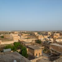

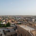
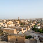
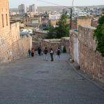
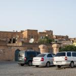
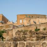
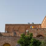
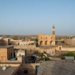
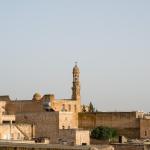
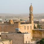
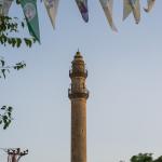
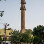
General Views over Midyat

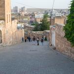
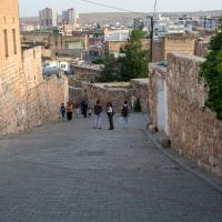
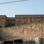
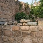
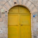
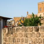
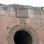
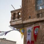
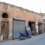
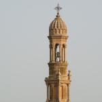
Various Buildings & Street Views within Midyat

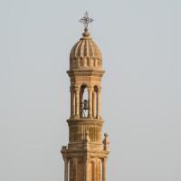
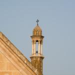
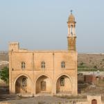
Bethel Church ("Protestant Church")
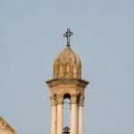
Mar Sharbil

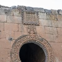
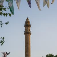
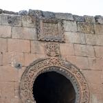
Cevat Paşa Cami
Description & Iconography
“Description & Iconography” general sources: Sinclair 1989, 315–317; Hollerweger et al. 1999, 94–107; Yanmaz 2001; Dalkılıç 2012.
History
Midyat seems to have been settled by the time of the Neo-Assyrian Empire. It has been identified with the place-name of Matiāte known from cuneiform inscriptions.1 An inscription of Assurnasirpal II states that during his campaigns in the region (879 BC), the city fell, and he erected here an inscribed monument (now lost).2 Beyond this, almost nothing is known about Midyat’s history during antiquity, as no archaeological excavations have been conducted at the site. Its history during the Middle Ages is almost as obscure, and it is mainly known from sporadic ecclesiastical sources stretching between Late Antiquity and the 15th century AD.3
During the Ottoman era, Midyat grew to become the center of a sub-district (kaza) within the sanjak of Mardin. Travelers passing through Midyat in the mid-19th century describe a population of about 450 families and a settlement of small, stone-built houses.4 The city hosted a school for masons, who were active in Midyat, Mardin, and other nearby towns.5 It is clear that the later 19th century saw a flurry of building development around Midyat. By 1890—as the population had swelled to roughly 6,000 inhabitants—it had a municipal town hall and numerous mansions attesting to the wealth of many residents.
For most of its history, Midyat’s population was mainly Christian; the majority were of the Jacobite denomination, but other groups were active here has well. It was named as a diocese by the 14th century. Throughout the Ottoman period, the Muslim community tended to live in nearby Estel. Midyat suffered greatly during the conflicts that roiled the area during the World War I years, as a great number of inhabitants lost their lives and historical buildings were destroyed. Reconstruction began in the 1930s. Many edifices were rebuilt in traditional methods, though modern constructions began to appear as well. Shortly after World War II, Midyat and Estel were merged into a single municipality. The city’s Christian population gradually decreased through the 20th century, with emigration accelerating from the late 1970s; however, Midyat remains the seat of the Tur Abdin’s Jacobite bishopric, a role it shares with nearby Mor Gabriel. The city, home to approximately 50,000 residents, serves as the region’s administrative center (ilçe).
- 1. More specifically, this name is found in royal inscriptions of Assurnasirpal II and Shalmaneser III; see Radner 2006, 291.
- 2. The campaign is related in the “Annals” inscribed on the walls and floors of the Ninurta temple at Nimrud, on two free-standing stelae, the “Nimrud Monolith” erected at the entrance of the same temple, as well as on the “Kurkh Monolith” discovered at Kurkh/Üçtepe on the Upper Tigris (Radner 2006, 287).
- 3. See esp. Takahashi 2011.
- 4. Badger 1852 (1), 54–56.
- 5. See Tomas Çerme, “Taşçılık zanaatı ve mimarisiyle Mardin şehri,” Tarih ve Toplum 200 (2000): 15–18.
“History” general sources: Cuinet 1891, 514–516; Anschütz 1975, 181–182; Hollerweger et al. 1999, 94–107; Radner 2006.
Early Publications
Midyat was not as often on the itinerary of early travelers as was nearby Mardin. George Percy Badger left the most detailed record of his impressions, having stayed for one day in Midyat in the 1840s.1 In the late 19th and early 20th centuries, studies of the Tur Abdin district began to include more detailed information on Midyat’s topography and monuments; notably, Gertrude Bell visited in 1909 and captured photographs of the city’s historical churches (including the medieval ruins of Mar Philoxenos, now heavily restored).2
Selected Bibliography
Anschütz, Helga. 1975. “Einige Ortschaften des Tur ‘Abdin im sudösten der Türkei als Beispiele gegenwärtiger und historischer Bedeutung.” Zeitschrift der Deutschen Morgenländischen Gesellschaft, Suppl. 3 (1): 179–193.
Badger, George Percy. 1852. The Nestorians and Their Rituals. 2 vols. London: J. Masters.
Bell, Gertrude, and Marlia Mundell Mango. 1982. The Churches and Monasteries of the Tur ‘Abdin. London: Pindar. Reprint, with new preface, notes, and catalogues, of Gertrude Bell’s The Churches and Monasteries of the Tur ‘Abdin (1910) and Churches and Monasteries the Tur ‘Abdin and Neighboring Districts (1913).
Dalkılıç, Neslihan. 2012. “The Architectural Analysis of Traditional Houses of Midyat-Mardin, Turkey.” International Journal of Academic Research 4 (2): 10–31.
Hollerweger, Hans, et. al. 1999. Turabdin: Living Cultural Heritage. Linz: Freunde des Tur Abdin.
Radner, Karen. 2006. “How to Reach the Upper Tigris: The Route through the Tūr ‘Abdīn.” State Archives of Assyria Bulletin 25: 273–305.
Sinclair, Thomas A. 1989. Eastern Turkey: An Architectural and Archaeological Survey. Vol. 3. London.
Socin, Albert. 1881. “Zur Geographie des Tur ‘Abdīn.” Zeitschrift für Deutsche Morgenländische Gesellschaft 35: 237–269.
Takahashi, Hidemi. 2011. “Midyat.” In Gorgias Encyclopedic Dictionary of the Syriac Heritage: Electronic Edition, edited by Sebastian P. Brock, Aaron M. Butts, George A. Kiraz and Lucas Van Rompay. https://gedsh.bethmardutho.org/Midyat.
Yanmaz, Sezin. 2001. “Bir tasarım objesi olarak geleneksel Midyat evi.” Ph.D. Diss., Istanbul Technical University [in Turkish].