Site Profile
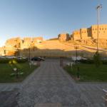
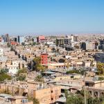
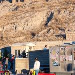
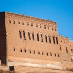
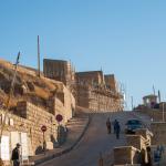
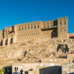
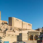
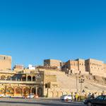
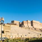
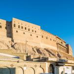
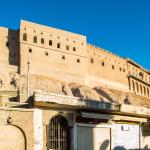
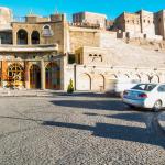
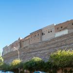
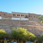
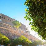
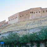
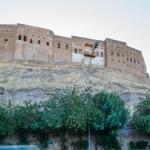
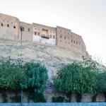
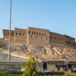
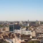
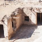
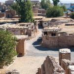
Erbil/Hawler, capital city of the Kurdish Autonomous Region of Iraq, is located about 350 km northeast of Baghdad and 80 km east of Mosul. It commands a key position on the fertile plain between the Great and Little Zab rivers, with the Tigris River to the west and the Zagros Mountains to the east. It is one of the longest continuously inhabited sites in the world. Its ancient name was Arbela (Arba-Ilu: “[The City] of Four Gods”). Over the centuries, successive layers of settlement have formed the citadel mound, which now rises 28–32 m above its surroundings. Most of the buildings on the current citadel date to the Late Ottoman period. Below the citadel are several historical structures, including a traditional covered marketplace (qaisariya) of the Late Ottoman period, interspersed in the densely populated modern city below the slopes of the citadel. Farther away from the citadel, but still within the modern city, is the Choli Minaret of the medieval era.
Media
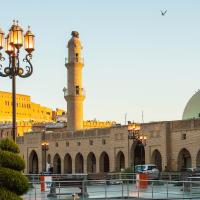


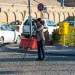
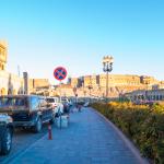
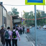
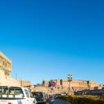
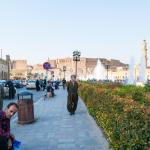
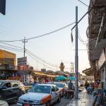
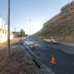
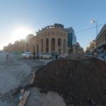
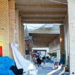
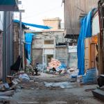
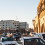
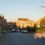
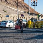
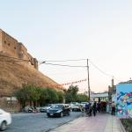
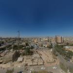
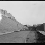
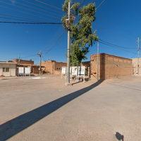
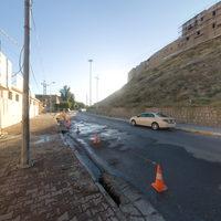
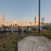
Lower City: General & Street Views
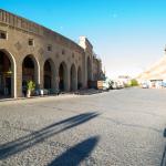


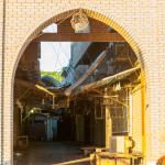
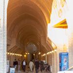
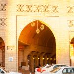
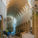
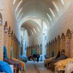
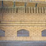
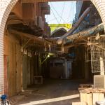
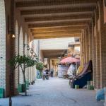
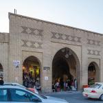
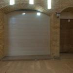
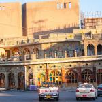
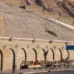
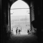
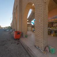
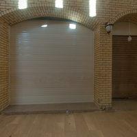
Brick Arcade & Marketplace
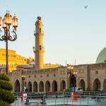
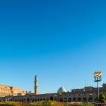
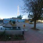
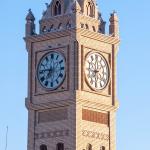
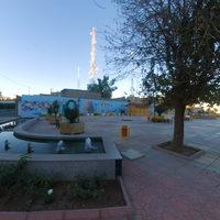
Clock Tower


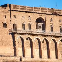
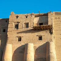
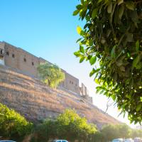
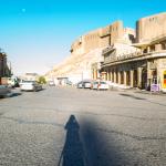
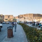
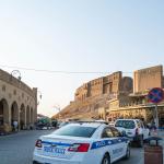
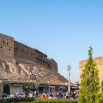
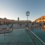
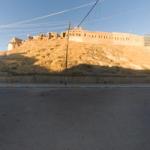
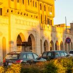
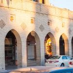
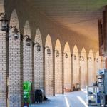
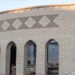
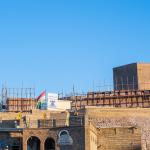
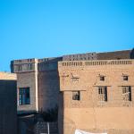
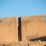
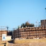
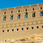
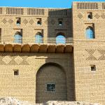
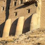
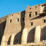
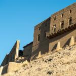
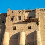
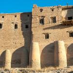
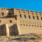
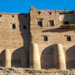
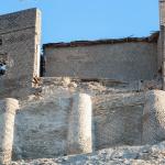
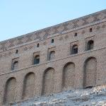
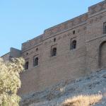
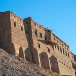
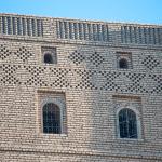
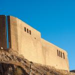
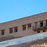
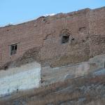
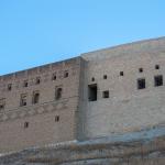
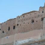
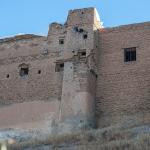
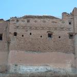
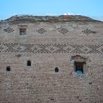
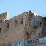
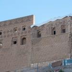
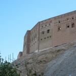
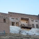
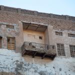
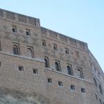
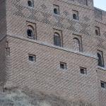
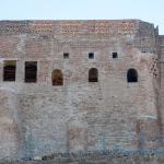
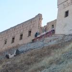
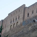
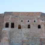
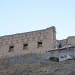
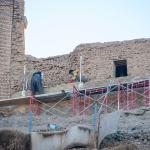
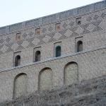
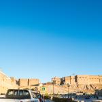
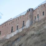
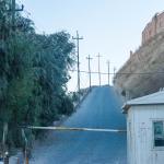
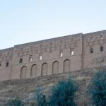
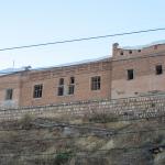
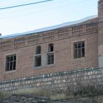
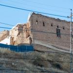
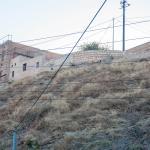
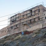
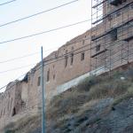
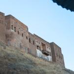
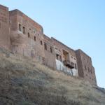
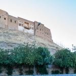
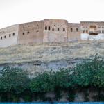
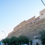
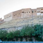
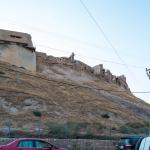
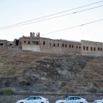
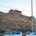
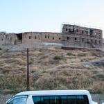
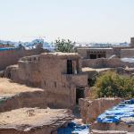
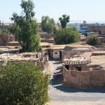
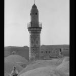
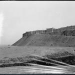
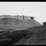
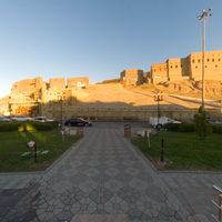
Citadel Perimeter & Surrounding Buildings
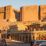
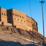
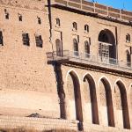
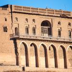
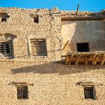
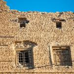
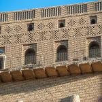
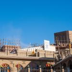
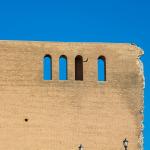
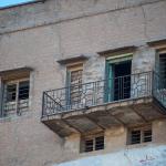
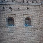
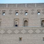
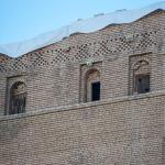
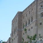
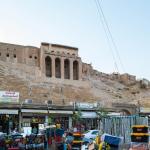
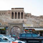
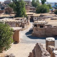
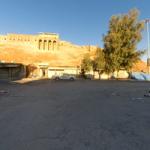
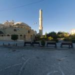
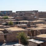
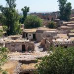
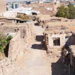
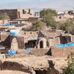
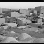
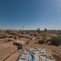
Citadel: General Street Views
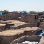
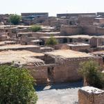
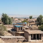
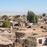
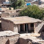
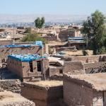
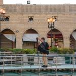
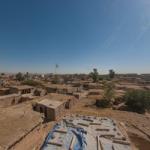
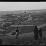
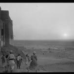
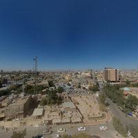
Rooftop of House B13 and Views over Erbil
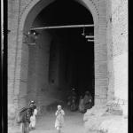
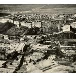
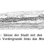
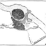
Historical Photographs
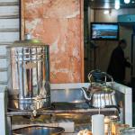
Supplementary Images


Description & Iconography
Description & Iconography” general references: Hasan1985; HCECR 2012; Palumbo et al. 2012; Nováček et al. 2013; al Yaqoobi et al. 2016a; al-Hashimi 2016; Abbas 2017; High Commission for Erbil Citadel Revitalization (website).
History
Erbil is frequently described as the oldest continually inhabited settlement in the world. Indeed, ceramic evidence suggests that the site was already inhabited in the Ubaid period. Its ancient name survives in its modern name Erbil. The earliest probable attestations of this name date to the Akkadian period (late 3rd millennium BC), when a site called “Irbilum” or “Urbilum” is mentioned in texts found at Ebla and elsewhere.1 Later texts indicate that the city was sacked by the Ur III ruler Shulgi (r. 2094–2047 BC), and by 2044, during the reign of Amarsin, it had come under the hegemony of the Ur III dynasty.2 During the Middle Bronze Age, the city was part of the state of Qabra, while during the Late Bronze Age it came under the control of the Assyrians, who called it Arbail or Arbela (from 'Arba-Ilu,' [City of] the Four Gods). Throughout the Middle and Neo-Assyrian periods, Arbela was a major population center, strategically located along important trading routes; it was also renowned for its sanctuary of Ishtar (Egašankalamma). The goddess was known as Ishtar of Arbela and was often addressed as “Lady of Arbail” in the inscriptions of the Neo-Assyrian kings. Ashurbanipal repaired Ishtar’s temple as well as the city walls during his reign (669–631 BC); a schematic depiction of Arbela, in which the king performs a religious ceremony before a building probably representing the temple, is found on a relief from the North Palace at Nineveh.3
During the Achaemenid period, Arbela retained its importance as the capital of the satrapy of Assyria. Alexander’s famous battle of Gaugamela was fought nearby (and is thus also known as the Battle of Arbela). Following the wars of the Successors, the city fell into Seleucid control—becoming the center of a province known as Adiabene, the core of which lay in the area between the Zab Rivers. Adiabene became part of the Parthian Empire during the second half of the second century BC. Through the course of the late Seleucid and early Parthian periods, the kingdom of Adiabene grew increasingly independent. According to Josephus, several of its ruling dynasts converted to Judaism, most prominently Izates II (r. ca. 36–60 AD).4 The figure carved on the Batas Harir relief, 50 km north of Erbil, may represent an Adiabenean king. During the wars between the Parthians and Romans, Arbela was not infrequently found in the crosshairs.5 With the conquests of the Sasanian ruler Ardashir in the 220s, Adiabene was absorbed into the Sasanian Empire and remained a province for the next 400 years. By the early 5th century, Arbela was a locus of a Christian community in northern Mesopotamia.6
Almost all information about ancient Arbela derives from textual sources: because of the continuous occupation of the citadel, large-scale archaeological explorations of the ancient layers have not taken place. However, some unpublished excavations were made during the reconstruction of the south gate in the 1970s; these yielded Neo-Assyrian artifacts now kept in the museum of Erbil/Hawler.7 Further archaeological excavations have been ongoing since 2006 and have already yielded new information about the ancient settlement.8
Limited information on the city’s history in the early medieval period survives; its importance seems to have faded for a time as Mosul rose in prominence under the early Islamic dynasties. By the mid-11th century, control of Erbil was in the hands of the Hadhbani Kurds. In 1128, the city was taken by Imad al-Din Zengi, though it was governed by the general Zayn al-Din ‘Ali Kuçuk. The latter founded the local Begteginid dynasty, which presided over the medieval city’s most prosperous phase, particularly during the reign of Muzzafar al-Din Gokburi (r. 1190–1232). This ruler was celebrated by the medieval historians for his architectural patronage, particularly in the lower town, which he developed to the south and west of the citadel.9 Additionally, he established a famous celebration of Mohammed’s birth, the Mawlid al-nabi, for which travelers came to Erbil from far and wide. At the same time, the city retained a large Christian population, and numerous churches were reported to have stood upon the citadel (none of these survives, however).10 The city was also home to a significant Jewish community.11
After the death of Muzzafar in 1232, Erbil suffered internal power struggles and an attack by Mongol armies, who burned the lower town and besieged the citadel. The citadel held out until 1258, when Hulagu formed a military alliance with Badr al-Din Lu’lu’ of Mosul. After 1514, the Ottomans attempted to bring Erbil into their sphere of influence, though they could not maintain continous rule, and control of the city alternated among a number of principalities. During the Ottoman-Persian contest for Mesopotamia—and more particularly, during Nadir Shah’s campaign of 1743—Erbil was badly sacked (which is why almost nothing survives of the city from before this time; the Choli Minaret is the main exception). After the rebellion of the Kurdish dominions in the late 1840s, the city and region were placed under the direct control of the Ottoman administration: initially as part of the Baghdad Vilayet, and later, from 1870, that of Mosul (sanjak Shahrizor). This was a relatively prosperous time for Erbil, as the many stately homes dating to the Late Ottoman period attest.
With the fall of the Ottoman empire after World War I, the region of Erbil was incorporated into the British Mandate and later the Kingdom of Iraq. The citadel was gradually depopulated after World War II, and many of its buildings fell into ruins; meanwhile, the lower city expanded rapidly, with the overall population burgeoning to an estimated 1.5 million today. Under the terms of the Iraqi Constitution of 2005, it has been the capital of the Kurdistan Regional Government. Since 2007, the citadel has been the focus for ongoing revitalization efforts under the High Commission for Erbil Citadel Revitalization.12 The residents of the citadel were relocated so that these restoration works could proceed.13 The citadel was inscribed in the list of UNESCO World Heritage sites in 2014.14
- 1. TM.75.G.2428 obv.xxiv.3 and TM.75.G.2429 obv.xiii.26. See HCECR 2012, 63.
- 2. See the summary of the sources in Unfer 1928; HCECR 2012, 63–64.
- 3. For the inscription describing Ashurbanipal’s renovation of Arbail, see Jamie Novotny, Selected Royal Inscriptions of Assurbanipal: L3 , L4 , LET, Prism I, Prism T, and Related Texts (SAACT 10) (Helsinki: Neo-Assyrian Text Corpus Project, 2014), 80–81, 99. On Ashurbanipal’s relationship with Ishtar of Arbail, see further in Porter 2004. North Palace relief: Paris, Louvre (AO 19914). See the line drawing in Victor Place, Ninive et l’Assyrie, vol. 3 (Paris: Imprimierie impériale, 1870), pl. 41.
- 4. As reported in Josephus, Antiquities of the Jews 20.2–4.
- 5. Notably, when Caracalla took the city in 216, his troops reportedly desecrated the “royal tombs” (probably those of the local dynasts); see Dio Cassius 71.26 and 74.1.
- 6. On the early Christian community of Arbela, which was the seat of a metropolitan bishopric, see Fiey 1965, 39–60.
- 7. However, note that a number of excavations were conducted at Tell Qalinj Agha, a smaller mound within the present-day city limits, in the 1960s–1970s (see, among other reports, Behnam Abu al-Soof, Excavations at Tell Qalinj Agha (Erbil),” Sumer 25 (1969): 3–42; I. H. Hijara, “Excavations at Tell Qalinj Agha,” Sumer 29 (1973): 13–34 [in Arabic]).
- 8. See Nováček et al. 2008, 266–298 (including ancient ceramic finds; medieval and later material also reported here). See the recent overview and plans for further excavation of the citadel in al Yaqoobi et al. 2016b. Also note that in 2008, a Neo-Assyrian chamber tomb was accidentally discovered just northwest the citadel, leading to rescue excavations; see Van Ess et al. 2012.
- 9. See the citations in Nováček et al. 2013, 7–8.
- 10. Notably, with the downfall of Baghdad in 1258 AD, the patriarch moved his seat to Erbil. However, most of the Christian population was lost by 1310 (see Fiey 1965, 77–91).
- 11. For instance, Al-Ḥarizi (d. 1225 AD) observes that Jews numbered among the city’s noblemen. On Erbil’s Jewish community from the medieval period until 1950, see Ashtor 2007 (citing the primary sources).
- 12. High Commission for Erbil Citadel Revitalization: http://www.erbilcitadel.org.
- 13. See the website of the High Commission for Erbil Citadel Revitalization: http://www.erbilcitadel.org.
- 14. See the UNESCO site entry at: https://whc.unesco.org/en/list/1437/.
History general sources: Unfer 1928; Streck 1936; Fiey 1965, 39-97; Nováček et al. 2008, 260–262; Hansman 2011; HCECR 2012, 62–77; Nováček et al. 2013, 1–5.
Early Publications
A number of primary sources contribute to the understanding of the city and people of Erbil during the medieval period. Among other Arabic-language historians/geographers, Yaqut al-Hamawi (d. 1229 AD) was in Erbil in the 1220s and provided a detailed description of the city during the reign of Muzzafar.1 Through these accounts, we know of the general outline of both the citadel and lower town. Numerous primary sources, such as the work of the Syriac chronicler Bar Hebraeus (d. 1286 AD), tell the history of Erbil’s Christian community of the same period.2
Erbil was frequently visited by Western travelers during the 18th, 19th, and early 20th centuries.3 At this time, several drawings were made of the tell/citadel from a distance (see the drawing of Claudius Rich; see the drawing of Eugène Flandin; see the drawing of Ernst Herzfeld). Ernst Herzfeld also drew a rudimentary diagram of the citadel and lower town as they stood during the time of his visit in 1916. The British military officer W. R. Hay published an early aerial photograph of the citadel in 1921.4
Selected Bibliography
Abbas, Ahmed. 2017. “Erbil Citadel Revitalization and the Presence of Its Emergence History.” In Rehab 2017: Proceedings of the 3rd International Conference on Preservation, Maintenance and Rehabilitation of Historic Buildings and Structures, edited by Rogério Amoêda, Sérgio Lima, and Cristina Pinheiro. Barcelos, Portugal: Green Lines Institute for Sustainable Development.
Al-Hashimi, Farah W. S. 2016. “The Hidden Face of Erbil: Change and Persistence in the Urban Core.” Ph.D. Thesis, Nottingham Trent University.
Al Yaqoobi, Dara, et al. 2016a. Highlights of Erbil Citadel. Erbil: High Commission for Erbil Citadel Revitalization.
Al Yaqoobi, Dara, et al. 2016b. “Archaeological Excavations on the Citadel of Erbil: Background, Framework and Results.” In The Archaeology of the Kurdistan Region of Iraq and Adjacent Regions, edited by Konstantinos Kopanias and John MacGinnis, 1–10. Oxford: Archaeopress.
Ashtor, Eliyahu. 2007. “Irbil.” In Encyclopaedia Judaica, edited by Michael Berenbaum and Fred Skolnik, 2nd ed., vol. 10, 24–25. Detroit: Macmillan Reference.
Gandreau, David, and Sébastien Moriset. 2013. “Conservation of Erbil Citadel, Iraq - Assessment of the Situation and Recommendations.” CRAterre‐ENSAG Mission Report.
Hansman, J. F. 1986. “Arbela.” In Encyclopaedia Iranica, vol. 2 (3): 277–278.
Hay, William R. 1921. Two Years in Kurdistan Experiences of a Persian Officer, 1918–1920. London: Sidgwick & Jackson.
Herzfeld, Ernst. 1920. “Sindjār.” In Archäologische Reise im Euphrat- und Tigris-Gebiet, vol. 2, by Friedrich Sarre and Ernst Herzfeld, 305–348. Berlin: D. Riemer.
High Commission for Erbil Citadel Revitalization (HCECR). 2012. Nomination of Erbil Citadel (Kurdistan Region, Iraq) for Inscription on the UNESCO World Heritage List. Vol.1. Erbil: High Commission for Erbil Citadel Revitalization.
High Commission for Erbil Citadel Revitalization (website). Accessed February 3, 2016. http://www.erbilcitadel.org.
Kowalczyk, Marek, and Mirosław Olbryś. 2019. “The Citadel in North Mesopotamian Erbil (Iraq): Challenges for the Preservation and Adaptation to New Function of an Ottoman-Period House.” In Stories Told around the Fountain: Papers Offered to Piotr Bieliński on the Occasion of His 70th Birthday, edited by A. Pieńkowska, D. Szeląg, and I. Zych, 333–354. Warsaw: University of Warsaw Press.
Kurapkat, Dietmar. 2016. “Two Ottoman Trade Buildings (Qaisariya) in the Bazaar of Erbil from Building Archaeology to Refurbishment Planning.” In The Archaeology of the Kurdistan Region of Iraq and Adjacent Regions, edited by Konstantinos Kopanias and John MacGinnis, 173–180. Oxford: Archaeopress.
Mohamed, Z. A. 2009. “Minbar al-jami‘ al-kabīr fī qal‘at Arbīl.” Subartu 3: 194–195 (in Arabic).
Müller-Wiener, Martina, and Anne Mollenhauer. 2016. “The Bazaar of Erbil within the Context of Islamic Trade Routes and Trade Buildings.” In The Archaeology of the Kurdistan Region of Iraq and Adjacent Regions, edited by Konstantinos Kopanias and John MacGinnis, 249–256. Oxford: Archaeopress.
Nováček, Karel, et al. 2008. “Research of the Arbil Citadel, Iraqi Kurdistan, First Season.” Památky Archeologické 99: 295–302.
Nováček, Karel, Narmin Ali Muhammad Amin, and Ali Melčák. 2013. “A Medieval City within Assyrian Walls: The Continuity of the Town of Arbīl in Northern Mesopotamia.” Iraq 75: 1–44.
Palumbo, Gaetano, et al. 2012. Erbil Citadel Management Plan. Pamphlet prepared for UNESCO.
Pavelka, K., J. Svatušková, and V. Králová. 2007. “Photogrammetric Documentation and Visualization of Choli Minaret and Great Citadel in Erbil/Iraq.” In Proceedings of the 21st CIPA Symposium: AntiCIPAting the Future of the Cultural Past (ISPRS Archives, Vol. 36-5/C53), 245–258. Athens: CIPA.
Porter, Barbara Nevling. 2004. “Ishtar of Nineveh and Her Collaborator, Ishtar of Arbela, in the Reign of Assurbanipal.” Iraq 66: 41–44.
Streck, M. 1927. “Irbil.” In The Encyclopaedia of Islam, 1st ed., vol. 4: 521–523. Leiden: Brill.
Unfer, E. 1928. “Arbailu.” In: Reallexikon der Assyriologie und vorderasiatischen Archaologie, vol. 1 (3): 141–142. Berlin/Leipzig: Walter de Gruyter.
Van Ess, Margarete, Arnulf Hausleiter, Haydar H. Hussein, and Nader B. Mohammed. 2012. “Excavations in the City of Arbil, 2009–2011: The Neo-Assyrian Tomb.” Zeitschrift fur Orient-Archaologie 5: 104–165.